
LUDDENDEN WALKS NUMBER 1
THE WALK
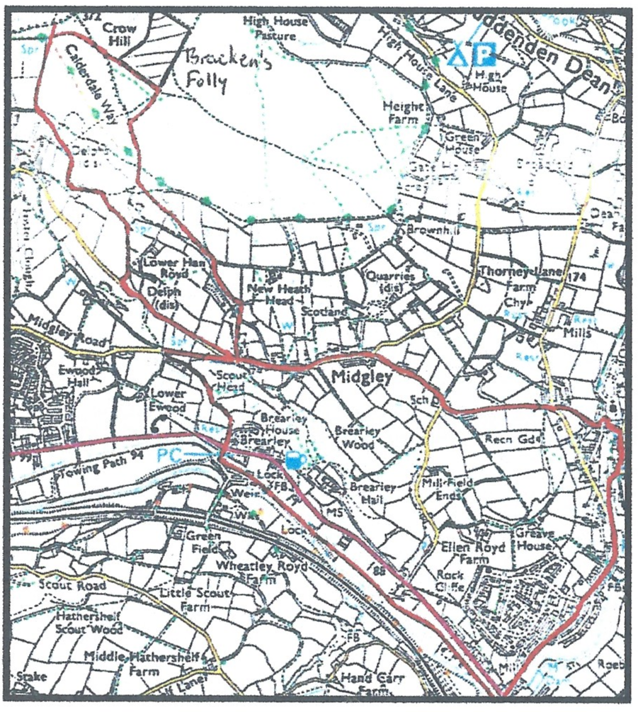
| Distance: 10½ km or 6½ miles (the route is shown in red on the map). Time: about 2½ to 3½ hours (including refreshment and view stops). Paths: mainly on roads, canal towpath and good paths. Strenuousness: there’s one significant uphill section with a more (optional) strenuous loop on to the moors. Facilities: Lord Nelson pub (check opening times). The toilets in the car park at the start of the walk are now closed. Starting Point: Car park along Luddenden Lane, (O.S. Grid reference 04168 25731) There is a very good information board about the Luddenden area in the car park. |
SOME BACKGROUND TO MIDGLEY TOWNSHIP
After the Romans left Britain in AD410, many people came over to Britain from the continent, particularly Angles and Saxons. Eventually, trees were cleared and village settlements began to form. Where trees had been cleared, the name of the settlement ended in –leah or ley. The clearing called Miclei, later became Midgley or the midge clearing.
The first mention of Midgley occurs in the Domesday Book of 1086 where it is described as one of the 9 berewicks (outlying areas) of Wachefeld (Wakefield). The manor of Wakefield was granted by the King in 1107 to the Earl Warenne of Surrey, for services rendered during the Norman invasion and afterwards, but later in 1351, the manor of Midgley was sub-let, thus giving it its own court to settle small matters such as debts, trespass and land disputes. The township would have a number of officials, the main ones being the grave (or greave), the constable, the churchwardens and the overseer of the poor.
The greave organised township work, collected rents and fines, presented offenders to the main Wakefield manor court in Halifax and was basically the Lord of the Manor of Wakefield’s steward.
The constable’s job was to maintain law and order, and minor misdemeanours were punished by putting the person in the village stocks. Stray animals found on the roads, or those taken in return for payment of fines were placed in the village pinfold, a round, stone enclosure. When the village school was built in Luddenden in 1819, lockups were incorporated in the building, one for the Midgley township and one for the Warley township.
The Surveyor of the Highways was responsible for the state of the roads, and keeping pinfold and stocks in good repair.
The road through Midgley was one of the main packhorse routes from Yorkshire through to Lancashire and it was important it was kept passable. People occupying land at the side of the road were responsible for its upkeep, and roads needing repair were named at the Wakefield manor court in Halifax. These had to be completed by the time of the next court in six months time. Major bridges were the responsibility of the county. Luddenden bridge was rebuilt of stone in 1518 and the Midgley manor would have its own delf or small quarry.
The Overseer of the Poor was allowed to levy a poor rate on the annual value of land and buildings for the relief of the poor. From about 1770, New Earth Head, a farmhouse on the edge of the moor was the Midgley workhouse, and it is still called Workhouse Farm by locals. For about 15 years after the Napoleonic wars of 1812-1825, there was much distress and unemployment, and the local Overseer put the able-bodied paupers to work on cutting out New Road from Carr Field to Duke Street in Luddenden to avoid the steep climb of the packhorse route up Old Lane.
One of the local industrialists, Jonathan Bracken also had the idea of paupers cultivating Midgley moor for food. This was not a success, however, because it was too bleak, exposed to the weather and very poor soil, and it quickly became known as “Bracken’s Folly’”
In 1894, Midgley Urban District Council was set up, but this was abolished in 1939, bringing to an end almost 900 years of Midgley being a separate administrative unit.
Walk directions and information about Midgley
1) Turn left out of the car park and walk along the road until you reach a narrow waymarked path on your left between the second and third pair of semi-detached houses. If you go to the bottom of this you will find an old packhorse bridge over Luddenden Brook (the Eastern boundary of the Township of Midgley).
This carried an old track from the Warley hillside over the river, across the road and up Greave House Fields towards Greave House (the house of the Greave) and on to Midgley. ln the West Riding list of 1752, this was “repairable by Luddenden and Midgley” A map by Saxton of 1599 showed the old Luddenden corn mill over the bridge across the river.
2) Retrace your steps back up the path and continue along the road to Luddendenfoot and cross the main road.
Opposite Kershaw House nursery, watch out for an old boundary stone embedded in the wall marking the boundary between Midgley Urban District and Luddendenfoot Urban District.
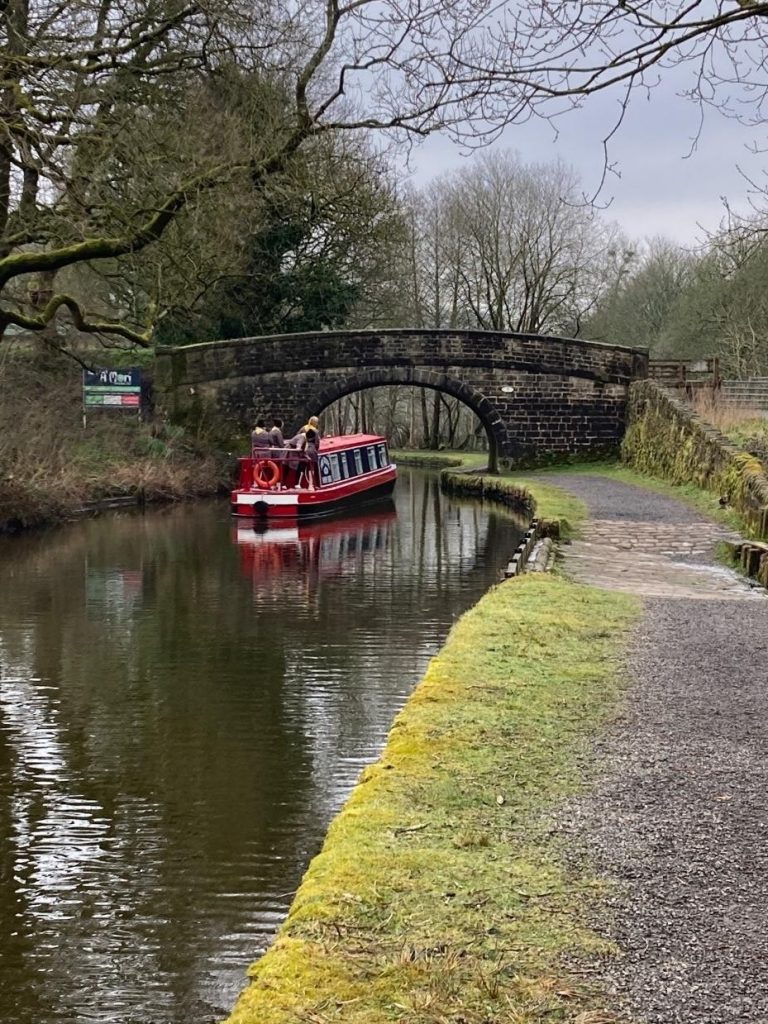
3) Go over the canal bridge and turn right onto the canal towpath by the Old Brandy Wine pub, in the direction of Brearley.
The Rochdale Canal was opened in 1798, with a wharf in Luddendenfoot at the Halifax side of the road bridge next to the houses. The canal is carried by an aqueduct (bridge) over the Luddenden brook.
4) Continue along the towpath for about a mile.
Along the way, you pass two spillways (overflows) where water can overflow into the river when there is heavy rain.
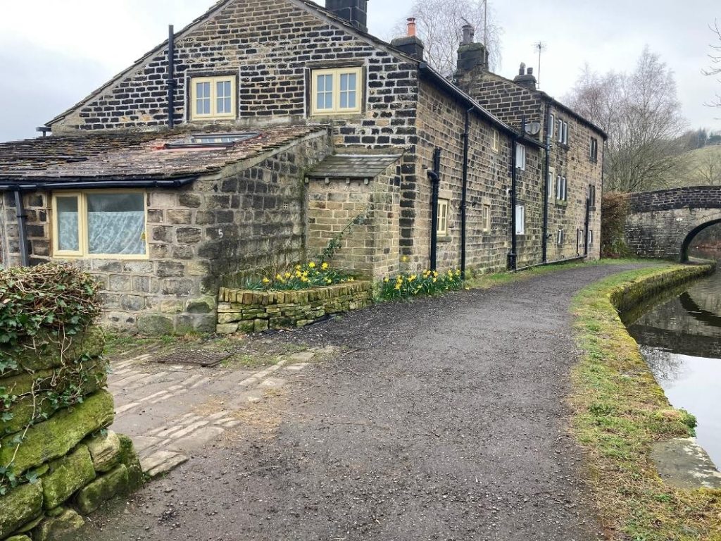
A short way along, you will see Upper Foot House. This was built in 1659 on the site of a previous house, and during the building of the railway in 1840, it became an inn for navvies.
A little way past there, you will see that the canal has been widened out. Boats brought coal from the Yorkshire coalfield and cotton from Lancashire to the mills at Luddendenfoot and Brearley. They would then tum round here in the turning circle and return with goods manufactured in the local mills.
5) Leave the towpath 30 metres before bridge 8, and turn left down Brearley Lane to the bridge at the bottom.
The river is the Southern boundary of the Midgley Township. The Midgley Manorial Corn Mill was on the left side of the river from about 1300 onwards until about 1850. All the corn grown in the manor had to be ground here for over 300 years. Returning up Brearley Lane, number 14 was Brearley Mill Inn, and later, the Clarence Hotel, where the last Midgley Manorial Courts were held in the 1850s.
6) Cross the road at the top, and to the right of the row of houses, hidden in the trees is Lower Brearley Hall.
There was originally a timber house here, and wood from this was used in the present house built about 1600. The Lords of the Manor of Midgley lived here for many years. In 1586, John Lacy, the then Lord, was the richest person in the Halifax district, and more taxes were raised in the Midgley township than in Halifax.
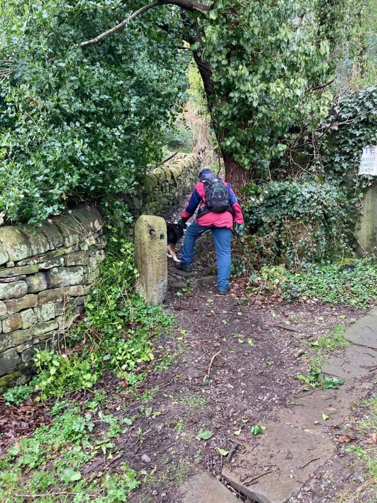
7) Go up the left side of the houses at Brearley Lane Top and take the path upwards through the wood (ignore right turnings). After about 500 metres you emerge onto a drive and then come out at a wide tarmac road which turns right uphill to Midgley.
8) At the top of the road, just before Midgley village, turn sharp left along the road for 500 metres.
You are now on what was one of the oldest packhorse routes through from Yorkshire to Lancashire.
9) Turn right up the farm track to Hanroyd, and then straight ahead at the junction with Upper Hanroyd. At the top of this rough track, go through a gate and bear left. You now follow the fence on your left for 400 metres where it joins an old quarry track.
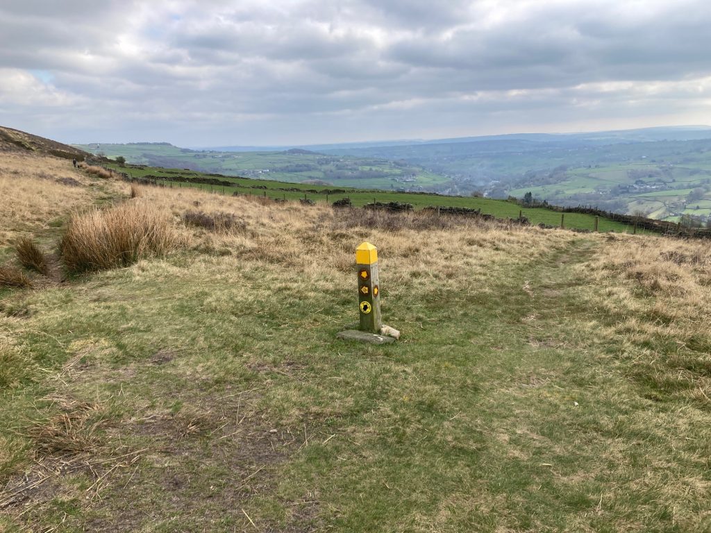
Follow the track down to a metal gate and pick up the path that doubles back at a white topped Post (a well walked permissive route which is a Calderdale Way Link path and is the Western boundary of Midgley
10) Follow this uphill with a wall on your left and a series of white topped posts. Towards the top it joins the Calderdale Way heading up to the standing stone Churn Milk Joan (and a nearby bench). .
This is actually a boundary stone separating the manors of Midgley and Wadsworth. Tradition has it that travellers should always leave a copper or two in the depression in the top for needy travellers, and you may find something in here if you are lucky.
11) From Churn Milk Joan, retrace your steps to the top of the Link path at the wall corner, here bear left and follow the yellow top posts marking the Calderdale Way gently heading down hill for about 600 metres. When you reach a marked junction, bear right at the waymark post
12) The path goes below a grazing field enclosed by stone walls. After 400 metres you come out at a junction of tracks where you bear right going downhill. At the next junction bear right continuing downhill (the left turn takes you to New Earth Head Farm, the old Midgley workhouse).
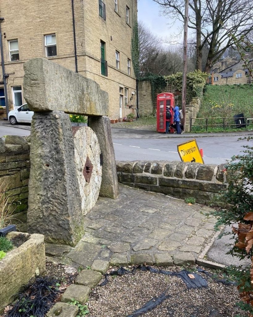
13) Shortly you turn right down a tarmac lane, but just before the junction, watch out on the right for a round, stone-walled structure of the Midgley pinfold, where stray sheep were impounded by the Constable.
14) At the bottom of the lane turn left along the main road through Midgley-Towngate.
A further 100 metres on the left, you will see a reconstruction of the old Midgley stocks.

15) Continue along the main road downwards, past the old Coop, then the school until you get to the Old Lane bus stop at a junction. Go down the ‘cobbled’ Old Lane (if it is wet and slippery, continue 200 metres down New Road, then turn left by the old school and you will arrive at the bottom of Old Lane).

The main road to Luddendenfoot is New Road, built between 1823 and 1825 by people receiving Poor Law benefits.
At the bottom of Old Lane, you will see the old Luddenden Junior School. Just round the right corner you will see two small doors of the lockups marked Midgley and Warley. There is also a third unmarked door, which some people believe may have been a cell for people from other areas.
16) Continue downwards through Luddenden, past The Lord Nelson Inn, built in 1634, which Branwell Bronte frequently patronised, over the 500 years old bridge, to the junction with Stocks Lane.
This is where the packhorse routes from Bradford and Halifax met and where the stocks are thought to have been sited.
17) Turn right, continue through the village past the junction with Halifax Lane, and eventually you come to the bottom of New Road and then back to the car park.