
Updated 13/02/2024
Length and time
5½ miles (9 km). Should take you about 4 hours including lunch and view stops.

Highlights
Old village of Mill Bank, good stretches of old causey paths, World War 2 starfish site at Flints, Catherine House Farm. Great views of Cragg Vale and Ryburne valleys.

Part of the route is the Sam Hill e-trail which you might want to use to get more information about the heritage of the area. See heart of the Pennines shop for details.

Gradients
The route has three significant climbs and descents, but they are spread out.

Terrain
The route is all on good paths, but some of the woodland sections may be boggy, especially after rain.

Obstacles
There are several stiles and some flights of steps on the route.

Facilities
Craggies (½ km off the route) 01422 417417
Hinchliffe Arms (300 metres into next section) 01422 883256
Robin Hood (1km off the route) 01422 885899

Bus access to the route
To get to Ripponden by bus (ask for Brig Royd stop)
•	901 from Huddersfield, Mytholmroyd and Hebden Bridge
•	Several services from Halifax
•	528 from Littleborough to Ripponden
1. From Old Bank Bottom, cross the main road and go up Royd Lane opposite for one hundred and fifty metres where you turn right between stone gate-posts
2. Go over a stile heading to a lovely stretch of paved path through fields to a terrace of houses. At the end of the terrace go straight ahead on to a walled lane which you follow until the lane turns sharp left. Here go straight ahead through a gap stile next to a gate.
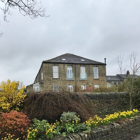
3. Keep alongside the wall at the top of the field and enjoy the great views of the Ryburn Valley. From this field pass through a gap stile and turn left into Cow Lane leading up to Soyland Town. Turn right at the road and after 150 metres you will see the 17th century building called Making Place Farm on your left.
4. Opposite Making Place Farm turn right down a paved path by a garden wall which comes out on to a track where you turn right. After 150 metres turn left through a gap stile to descend alongside a wall on your right.
5. The path descends and then goes down some rough stone steps. The path emerges on to a roughly surfaced drive where you turn left downhill.
6. Turn right at the road to descend to Mill Bank Bridge (SE035212). You might want a short detour to explore the hamlet or at least have a good read of the fascinating interpretation board by the bridge.
7. From the bridge in Mill Bank turn left up a lane, initially following the stream. The lane becomes a wide path climbing up through woodland. At the top, turn right up the tarmac lane.
8. Keep on this lane for ½ km where you come to a road junction. Go straight across Lighthazzles Road on to the road heading up hill called Eccles Parlour. Keep on this road (passing Hole Head) for ½ km and at the T junction, turn left.
9. After ½ km, just past Soyland New Farm, turn right into a wide track. At the junction of tracks, cross the stile straight ahead on to a footpath which follows the embankment of the derelict Flints Reservoir. At the end of the embankment, cross a stile and continue on a well-defined path over rough ground heading for a finger post on the skyline.
10. At the finger post, cross the wall and continue ahead up a broad stony track to a junction of tracks by the ruins of Flints wartime decoy station. Turn right along the track (initially stony and then grassy) on the moorland ridge passing through 3 gates.
11. After 1km, you reach a junction of tracks where you turn left, following the wall as it gently drops down.
At this junction Link Path B continues straight ahead to Steep Lane and eventually to the Rochdale Canal at Luddenden Foot.
12. After ½ km you pass Catherine House Farm, with its distinctive chimney and arrive at a road junction. Go straight across and after 150 metres turn left down a rough tarmac track.
If you turn left for about ½ km you reach the café called Craggies.
13. Pass through the gate, where the track becomes unsurfaced. After about 300 metres, where the track forks bear right towards ruined Deacon Hill Farm. The track turns left through a gate and descends to a farmhouse.
14. Just before the farmhouse, turn sharp left on a path heading downhill. The path goes across rough ground but is well defined. The path goes off to the left at a gap in the wall.
15. The route levels out and causey stones appear. Shortly after the path descends again through woodland. You reach a laurel hedge which is the edge of a garden and at the junction, turn right following the garden edge downhill. When you reach the tarmac drive, turn left downhill and you will shortly arrive at the main Cragg Vale road.
At this point, you have several alternatives:
The 901 bus to Ripponden and Huddersfield or to Mytholmroyd and Hebden Bridge – either walk up or down the Cragg Road where you will find bus stops.
To continue on to the next section, cross the road to the right and turn immediately left downhill to the bridge, passing the Church of St. John the Baptist in the Wilderness (SE001232). At the bridge:
- You turn left to walk on to the next section to Todmorden (passing the Hinchliffe Arms). Or
- Turn right to pick up Link Path C (at SE000232) which follows Cragg Brook down to the Rochdale Canal at Mytholmroyd.