
Updated 02/02/2024
Length and time
5½ miles (9km). Should take you 3 hours.

Highlights
Some wonderful panoramic views of Halifax and the Calder Valley, great mixed woodland, tranquil towpaths, the climbing wall at Brighouse and the canal basin and guillotine lock at Salterhebble.

Gradients
The start of the walk is level, along the canal, followed by a steady climb through woodland.  Thereafter the gradients are mainly downward or level, including two steep descents.

Terrain
The route is on a mixture of paths and tracks with some stretches of (relatively quiet) road walking. Crossing the dual carriageway near the end is currently difficult (February 2024).

Obstacles
There are several stiles and near the end of this section, an interesting crossing over the canal.

Facilities
Brighouse has several places to eat and drink.

Bus and train access to the route
To the start at Brighouse there are loads of buses from Halifax and Huddersfield. There are trains from Leeds, Halifax, the upper Calder Valley and Manchester.
From the end at Salter Hebble or West Vale there are several buses to Halifax.
Beginning at Brighouse:
Exit the railway station as signed on the platform then turn left to walk down the main road, across the river bridge, until you reach the canal (opposite Sainsbury’s). Turn left onto the canal towpath.
Exit bus station and follow signs for the railway station or ask for directions to Sainsburys where you turn left onto the canal towpath.
Continuing from Section 14:
Continue along the canal towpath.
1. With the canal to the left, follow the towpath under Anchor Bridge, passing the climbing towers to Ganney Lock (SE140229), a distance of about 750 metres.
2. At Ganney Lock, cross the bridge and continue along the towpath for about 700 metres to the metal clad Camms Mill where you turn right over the road Bridge. Continue ahead to cross Elland Road (A6025) and take the track opposite turning left through a metal gate and uphill through Freeman’s Wood keeping the wall on your left. There is a good show of bluebells in the spring.
3. Stay on the main track for 500 metres, until reaching power lines. Turn left onto the path between the first two pylons and go down the long flight of steps all the way to a farm. You have a good view of the valley and Cromwell Lake as you descend.
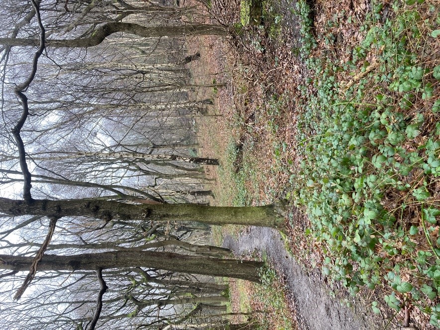
4. At the bottom of the steps turn right and follow the grassy walled track into Cromwell Wood for about 2 km. It becomes a walled path for about 150 metres, when you reach a 4-way junction.
5. Turn left down a setted path which goes over a stream and up to a farm lane. Turn right and almost immediately left, through a stile signed School Lane. Continue up the field-edge, following the wall on the right.
6. At the top of the field go through the stile in the corner (hidden behind a tree) and turn right along a fenced path and continue ahead, uphill along the tarmac road. At the junction, turn right towards the Ashday Lane bus stop and turn left into the road called West Lane.
7. Continue for about 1.25 km, passing Marshalls stone works on the left. As the panorama opens in front of you, the Wainhouse Tower on the edge of Halifax comes into view on the right. From here the view, takes in Halifax and large tracts of Calderdale.
8. About 1.25km from the Ashday Lane bus-stop, at a sharp right-hand bend in the road, bear left, onto a track to Wood Nook Farm. Immediately bear right onto a narrow path leading to a stile into a field.
9. Walk down the edge of two fields, keeping the field-wall to your right Just before the bottom corner turn right over a stone step-stile (easy to miss) and bear left towards an isolated tree at the end of a wall.
10. From the tree, walk straight on to the corner of a hedge, then continue straight on, now with a fence on your right, to a stile in the corner of the field. Cross the stile and continue downhill through another field to Exley Lane. Cross the stile and turn left along the road.
11. Follow the road past the cluster of buildings called Upper Exley to a left-hand bend. Here, turn right over the stile into a field and bear left, passing behind a barn. The path gradually leaves the barn to a stile below a pylon. Go right down the wall side to a further stile in the field corner. Go through this stile into the wood.
12. Take the waymarked path down through the wood, eventually reaching steps to the Elland By-pass (A629). Cross the dual carriageway, but do take care and be patient as the road is very busy. Take the track opposite which slants off left, then immediately bear right down a narrow path through the trees to Long Lees Lock.
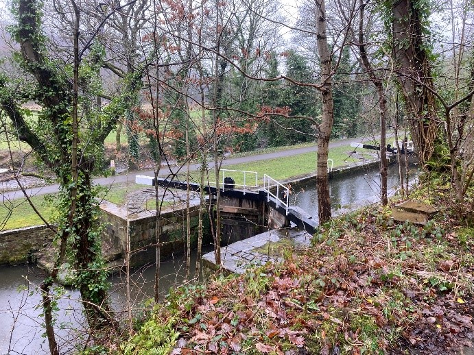
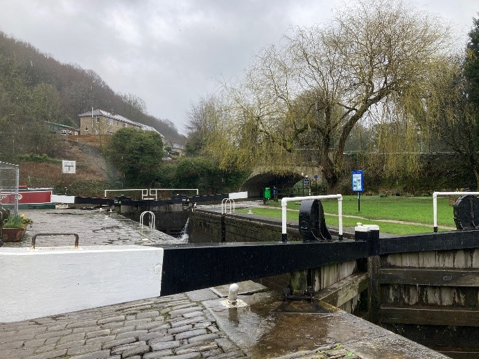
13. Cross the canal using the lock gate which doubles up as a bridge. Go right and follow the towpath to Stainland Road, using the pedestrian tunnel to reach the guillotine lock and canal basin at Salterhebble.
From the Lock basin you can take the Link Path M to Halifax. From the tunnel, go straight ahead around the canal basin and cross the bridge by the lock keeper’s house. Follow the canal towpath ahead which becomes a cycle path called the Hebble Trail.
14. To continue to the next section, just after the tunnel double back on a sloping upward path which will take you up to the busy Stainland Road. Turn right walk in the direction of Stainland, for about 0.5km.
- 15. After the railway bridge, a waymarked track goes off to the right, near a bus stop and car park. This leads to Clay House, West Vale (SE0972l4): the start of the next section