
BACKGROUND
There are two types of church that have existed in the Luddenden valley: The Church of England (Anglican), and the non-Conformist churches.
The Anglican Church is the established state church and originated when King Henry the Eighth broke away from the Roman Catholic Church in 1534.
Non-Conformist churches are those which conform to the same beliefs (not Roman Catholic) as the Anglican church, but have different services and organisation. Until 1685, they were illegal, but in that year, Parliament legalised them by passing what was known as the Toleration Act.
CHURCH OF ENGLAND – ST. MARY’S
The date of building the first church in Luddenden is not known, but a licence for a priest was given in 1496. It was probably sited somewhere near Kershaw House, the original name of which was Kirkshaw, the house in or near the church wood.
The next church, which was built on the present site was built sometime before 1599, as it appears on a map of Luddenden of that date. The priest was not allowed to baptise, marry or bury people until 1624, when it was compulsory to go to Church on Sunday.
During the civil war (around 1650), fonts for baptism and churchyard crosses were thought to be very Roman Catholic. Scottish Parliamentarian troops returning to Halifax after a battle at Heptonstall are thought to have thrown out and broken the font and cross. The font was found in the garden at Ellen Royd House at the beginning of the 20th century (you will see both this and the base of the cross on the walk).
By the early 1800s, the building was becoming very unsafe, so it was demolished in 1816 and the present church erected on the same site.
NON-CONFORMIST CHURCHES
There are a number of different non-conformist churches, each with their own method of administration and slightly different beliefs. The ones which had a chapel in the Luddenden valley were Congregational, Methodist and Baptist. All were the faith of people dedicated to hard work, thrift and competition, and the accumulation of wealth (though not extravagance of its display). These were seen as the outward signs of virtue, and unsurprisingly these churches were those of the working classes who by dint of hard work had bettered themselves.
In the early 19th century, the Anglican Church could only seat about 13% of the adult population, so large numbers of the non-conformist churches were built in every small village or hamlet to cater for the remainder. The most active was the Methodist Church, founded by John Wesley in the 18th century. By the 1800s, however, it had split into a number of slightly different branches, which often had chapels next door to each other.
There was a Congregational chapel at Booth, Methodist Chapels at Luddenden, Midgley, Luddendenfoot and Luddenden Dean and Baptist at Butts Green. All of these have now closed down, the last in 2011.
THE WALK
| Distance: 10.5 km. (6.5 miles) Time 3 to 4 hours Strenuousness: Medium to strenuous. Initially quite a climb. Path condition: All on good paths and tracks Facilities: Lord Nelson Inn. Open weekdays from 4pm, weekends from 12 noon. Midgley community shop. Buses: 574 bus Halifax – Midgley Starting Point: Car Park along Luddenden Lane (O.S. Grid reference 04168 25731) The route is shown in red on the map above. The walk was produced by Luddenden Conservation Society. |
DIRECTIONS AND INFORMATION ABOUT THE CHURCHES
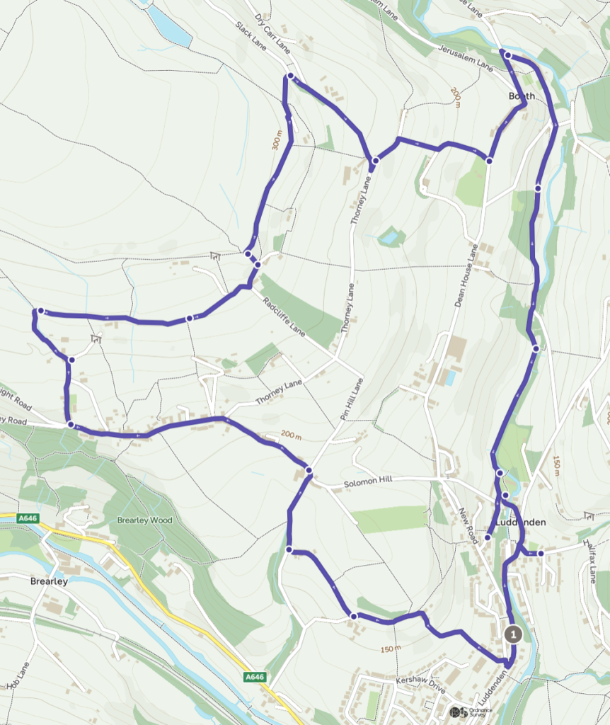
1) Turn left out of the car park and walk along to Kershaw House on your right just after Kershaw Drive.
The present house was built around 1640, but a previous house Kirkeschawe is mentioned as early as 1307. This suggests a church around there at that time, and there is a small, probably pre-reformation, oratory or private chapel over the porch.
2) Go up Kershaw Drive until you reach Greave House Drive on your left and look for a grassy path opposite, signposted Calderdale Way Link Path.

3) Go through a gate and take the path up the field on the right of the wall. At the top, turn left along the farm track for about 100 metres to a junction at a cluster of houses.
The house on the left at the junction is Ellen Royd, where the St. Mary’s font, which had been thrown out by the Scottish troops, was found in the garden.
4) Turn right along the bridleway until you reach the road at Mill Field End. Turn right along the road until you reach the main road at the top. Turn left here (along Jim Allen Lane) up the road into Midgley village. Continue along the road for 0.6 km. through the village to Chapel Lane.
The first Methodist Chapel in Midgley (Union Chapel) was built in 1819. From the beginning, reading and writing were taught, as there was no school in the village until 1877. The chapel became too small, so in 1883 it was demolished and a new Chapel (Providence) was built on the same site. This closed down in 1994 and was converted into apartments.
5) Turn right up Chapel Lane. The chapel is private, but you can do a short diversion to visit the graveyard which you pass on your right and further on the pinfold on your left. Bear left at Midgley Hall Farm onto a rough track leading upwards.
6) Continue along this track which turns right, ignore the footpath to the left. You are now on Workhouse Lane with fantastic views of the valley. Shortly after the house (which was once the Midgley Workhouse) at a junction, go straight ahead on a wide grassy path. Go through a gate, on to open fields following a wall and crossing 3 stiles.
7) Go straight ahead where the path joins a rough tarmac track and shortly after, turn up left at Moorside farm. Where the lane ends, go straight ahead on a wide grassy path to a gate where you turn right onto the Calderdale Way for 500 metres.
8) After passing alongside a house with solar panels the path bears to the left. 500 metres further on, the path runs alongside a tarmac lane. Go over the stile by the metal gate and turn left down the lane down to a junction.
9) Turn right along the road as far as the terrace of houses on the right, and then go immediately left down a bridleway (there are some steep stone steps to cut the corner). After 100 metres turn right down a wide stone setted lane (take care when wet), bear left between the houses and down to the road to the hamlet of Booth. Turn left along the road and continue through Booth, then downhill to the bottom of Booth Hill.
Halfway down Booth Hill, you come to the site of Booth Chapel (you are standing at the top left of the photo).
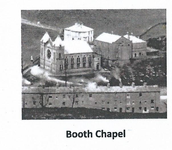
The first building is the Minister’s house (The Manse) built in 1823. Below the Manse was a second chapel (1828), which like the first on the same site became too small. At the bottom side of these was the third Chapel (1869), which was described by an eminent architectural historian as “the dominant feature in the village – like some miniature cathedral”.
Unfortunately, it closed down a few years before it had become the vogue to convert such buildings to other uses. The remaining surviving building, the 1851 Sunday School, is also now apartments. Calderdale council recently announced a small part of the graveyard will be used for natural woodland burials.
10) Turn sharp right at the bottom of the hill along Goit Side. Continue this road/track straight on for almost 1.5 km and you will come out in the centre of Luddenden, by the Lord Nelson. Just past Brook Terrace, keep ahead to the right and you will join a delightful riverside path.
Go right when you reach a pair of pillars (the entrance to the churchyard). When you come out at the Lord Nelson, turn left past the War Memorial and left again to go into the St. Mary’s Churchyard.
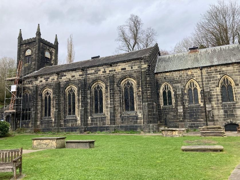
Halfway along the path to the Church on the left, you will see the octagonal stone base and pillar of the Churchyard cross, broken by the Parliamentary forces during the civil war. There are many fine 18th century gravestones and chest tombs Including one with a metal Murgatroyd arms set into the top.
The Church itself is usually open to visitors from (about) 10am until 6pm. The early font which was broken is on the left at the front of the Church by the altar, and its 1662 replacement on the left at the rear as you enter. The remainder of the Church is worth a good look around before you leave.
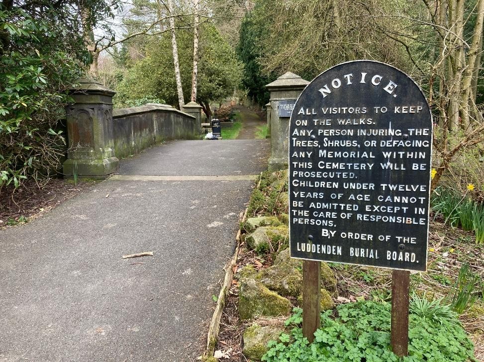
11) Come out of the church and turn right for a short diversion into the delightful graveyard and memorial gardens, but obey the rules!
12) Return to the war memorial onto the road (called High Street), turn right and then left behind the Lord Nelson for about 100 metres where you will see one of the three ex -methodist Churches in the village.
On the right at the top of the first steep section is the old Luddenden Junior School. This was built by a Church of England educational foundation and opened in 1823. It closed down in 1993 when a new school was built on the Kershaw Estate. Two lockups for the village constable were built into it, one for miscreants from the Midgley township and the other for those from the Warley township.
The use to which the third door was put is not known, although some people think it may have been for people from more distant townships. Each township was responsible for their own inhabitants, and they were maybe put there until their own village constable came to fetch them and take them home.
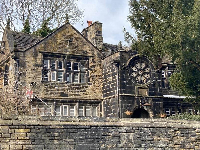
Further up the hill, you will come to what was the St. James’s Methodist Chapel. This was built in 1903 and closed down in 2011. It has now been converted into two separate houses. Above that, you will see the old Luddenden Infants School. When half time education became compulsory, the junior school did not have sufficient space for everyone, so a second school was built in 1870.
13) Turn round and go back down the hill, go past the war memorial and continue through the village, crossing the bridge to the junction with Stocks Lane. Continue for 50 metres where a setted lane called Chapel Street goes off to the left.
The building on the left just before Chapel Street is the earlier building of the St. James’s Chapel. This was built in 1837, when one of the Methodist splits occurred. The earlier Wesleyan Methodist Chapel (which you will see next across the road) was seen as too undemocratic.
Methodism relied on local lay preachers to take the services and do much of the work. Many of these, however, were penniless and receiving no help, so a large breakaway took place to form what was called the Wesleyan Association, and this was always the main church of the working classes. By the 1890s, the building was too small, so St. James’s Chapel was built across the valley.
14) Continue along the road for 30 metres, and then turn left up Halifax Lane by the Luddenden Hub in the red telephone box. Stop at the playground railings on your left.
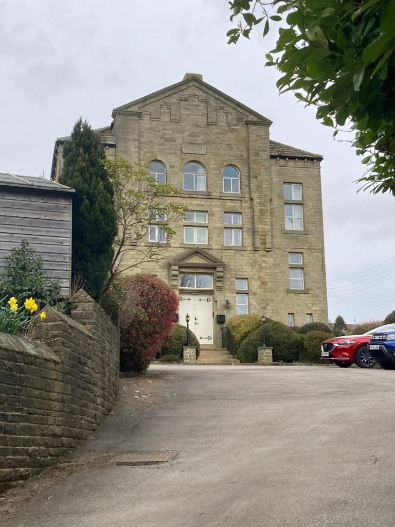
Until the 1950s, there were streets of houses here. One of these in 1787 was converted to a small preaching house.
In 1812, a Chapel called Ebenezer Chapel was built across the road for the Wesleyan Methodists when the preaching house became too small. In 1864, a larger Sunday School building was built, attached to the Chapel (see photo). At that time, over 350 children were registered members of the Sunday School, and it was the only place where most of them were taught to read and write.
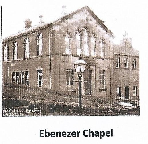
If you stand with your back to the railings of the playground, the new bungalow at the top left is on the site of the Sunday School. The gates were the main entrance to the Chapel (below the Sunday School on the photograph), and the lower house (originally two houses) were for Chapel workers such as the caretaker. Behind the two houses is a small, closed graveyard.
15) If you now return to the road at the bottom of the hill, turn left, continue through the village to the junction with New Road. A further 100 metres to the left along Luddenden Lane you arrive back at the car park.
The Methodist Chapel Higher up the valley at Luddenden Dene has not been included here as it would have increased the length of the walk substantially. The graveyard is the only part remaining, but it includes the well-known grave of orphans and other young girls from Liverpool who had been brought to work in the factory at Wainstalls. They were very well treated here, and had a much better life than they would have had in Liverpool, with many staying for the rest of their lives. It can be reached by car down the hill from Wainstalls, past the Cat I’th Well Inn.
A booklet Non-Conformist Chapels of the Luddenden Valley is available through the Luddenden Conservation Society.