
LUDDENDEN WALKS NUMBER 4
BACKGROUND
Before the 19th century, most textile production was carried out as a small-scale cottage industry. Towards the end of the 18th century, new inventions such as the flying shuttle (Kay), spinning jenny (Hargreaves) and spinning mule for fine yarn (Crompton) produced a tremendous expansion in the Lancashire cotton industry. As marginal grain production in the Luddenden valley gave way to cattle breeding, old corn mills became available, so from about 1770, cotton production became widespread in the Calder Valley. The cotton boom ended about 1820, but many mills then changed over to worsted production (a woollen material).
Early mills were small, but further developments in machinery gradually made the mills much bigger. Some of the smaller mills would just concentrate on a single process, such as spinning yarn, and many extended on the same site. From 1830 onwards, however, large mills such as Oats Royd were designed so that all the processes were integrated on one site. Staircases and toilets were usually a danger because of the risk of fire spreading through them, so they were often built in one corner of the mill or a projecting tower. From this time also, there was much more use of cast iron beams and stone floors, which made the mills more fireproof, and allowed the use of heavier machinery. Drying the cloth had originally been done out of doors in tenterfields. Horizontal terraces were cut in the hillside and the cloth was attached by tenterhooks on horizontal lengths of wood fastened to vertical posts in the ground. The whole construction would be tens of feet long. Eventually, it was done indoors by blowing warm air through slatted floors.
Mills were powered in two ways. Many used water-power via one or more water wheels. However, because of the number of mills in the Luddenden valley using the Luddenden brook, there was often not enough water in summer in the river. The mill owners formed the Cold Edge Dam Company, with three large reservoirs up on Wainstalls moor, which supplied ten mills with water. There were two other mills which did not go onto the Cold Edge system because they did not use a lot of water– Holme House Bridge mill, at the bottom of Booth Hill, and Pepper Hill mill, where Railes Close now stands. John Murgatroyd’s Oats Royd mills, however, were the most successful because he was astute enough to realise that water power could never provide sufficient energy, and coal-fired steam engines were used.
The great wealth of the mill owners meant that they often built a large house for themselves out of the profits, usually fairly close to the mill, and they often also provided public buildings and parks. For the workers, many small dwellings close to the mill and specifically for the millworkers were constructed. Between 1823 and 1825, at a time of great economic depression following the Napoleonic wars with France, New Road was cut out by unemployed workers to provide an easier alternative route to the steep climb up Old Lane from Luddenden to Midgley and Booth.
THE WALK
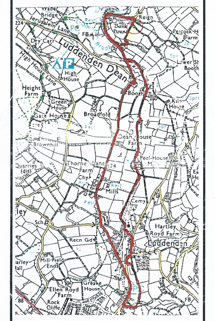
| Distance: 3.5 miles Time 2 to 2.5 hours Strenuousness: Moderate, with two sections uphill. Terrain: Mainly on Roads and tracks Facilities: Lord Nelson Inn. Open weekdays from 4pm, weekends from noon. Information Board in the car park. Starting Point.:Car Park along Luddenden Lane (0.5. Grid reference 04168 25731) The route is shown in red on the map above. The walk was produced by Luddenden Conservation Society. |
DIRECTIONS AND INFORMATION ABOUT THE MILLS.
1) Turn right out of the car park. After 100 metres, bear left at the junction up New Road.
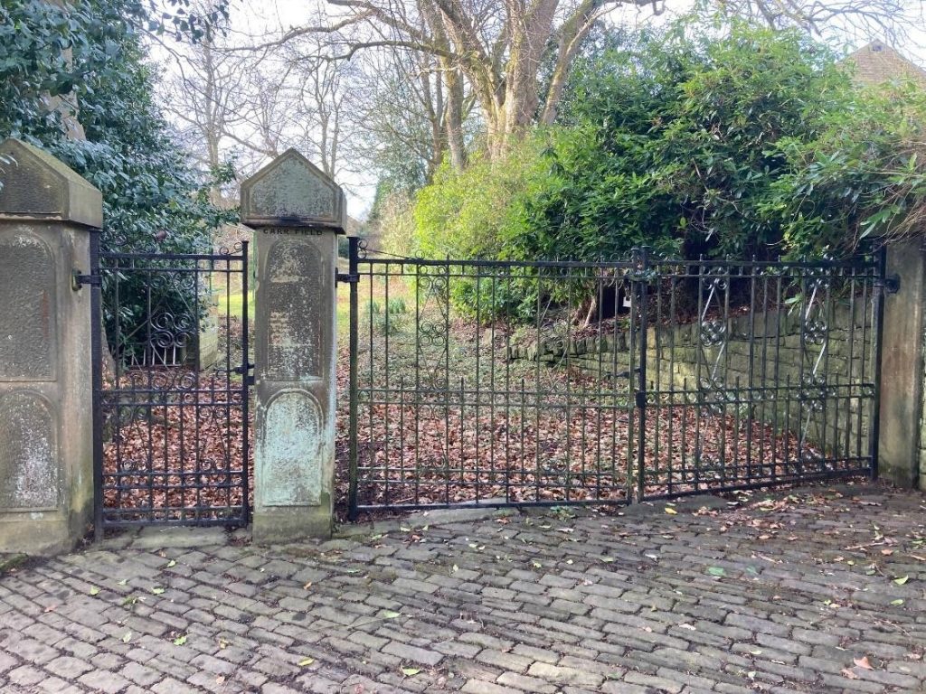
100 metres up New Road, you come to Carr Field Drive on the left. The estate was built on the site of Carr Field House, home of the Thompson family, who owned the Luddenden Corn Mill during the 19th century.
2) Continue up the road for 100 metres, to the junction with High Street down into the village.
Just below The Old School is the old Methodist Chapel, which was built in 1903 and closed down in 2011. The land and a sizeable amount of money for the building was provided by the Thompson family.
3) Continue up New Road to the junction, then bear right along the road towards Booth.
At the top of New Road, Old Lane on your right is part of the ancient packhorse trail through to Lancashire, and you can see from the steepness the need for New Road.
Across the road from the houses on Duke Street on the left, you can see an L-shaped green area. Along this area parallel to the road were workers’ houses for Oats Royd mill, similar to those across the road.
Down the side opposite Railes Cottages was a small dam which, along with a small one next to Bethel Terrace served Pepper Hill Mill where Railes Close has now been built. Worsted was manufactured here, but it was bought out by Murgatroyd’s at Oats Royd in the early 20th century and closed down.
4) Continue along the road for another 100 metres to Oates Royd House and Mill.
John Murgatroyd bought Oats Royd House and the estate in 1842, and proceeded to build his mills there. The first part of the mill is at the left on the western (top) side of the road, and 11 further extensions by 1887 resulted in one of the largest worsted mills in the West Riding.
The mill closed down in 1982, and a fire in 1989 severely damaged much of it. The block on the right is newly built on the site of that part of the mill which burned down. There are now almost 100 apartments altogether.
5) Continue along the road for 250 metres and shortly after the farm on the right, you come across the lodge to the largest of the Murgatroyd houses, Broadfold.
Broadfold was built by a later John Murgatroyd who also provided the Booth cricket field so he could watch the game from his terrace.
6) Continue along the road to Booth, go through the village and keep on the road downhill to the bridge.
Here you will see the site of the Holme House Bridge Mill, which was at right angles to the road. It had a water wheel which was taken to Shibden Hall for a mill display, and was buried somewhere underneath the car park. The first mill
here was built in 1495, and was a fulling mill where the cloth was trampled on initially to knit the fibres together. Eventually it was used for making spindles and machinery.
7) Continue up the road through the wooded area until you come to a house on the right where the road bends round to the left.
A short way up the road on the left, you can see where there was once a dam and a mill race or goit (underground waterway for supplying water to a mill). The dam was used by the next mill down the valley, Dean Mill. Further up the road if you look over the wall just past the houses at Jowler, you can see the mill dam and below it Jowler mill. This was used for worsted spinning until the 1970s.
8) Turn right down a wide path at the top side of the house Hill Corner which brings you almost to Holme House bridge again. Turn left at the bottom, and left again along the terrace of houses at Goitside.
As you go down the path, note its construction which allowed both humans and horses to use it when frozen.
The goit here is carried in a pipe underneath the road at Goitside. In times past, young people coming out of their apprenticeship with the Cold Edge Dam company had to race the water let out of one of the dams down to the bridge. If the water arrived first, he had some unsuitable dignity heaped upon him. Also, in times long past, boys would dare each other to walk along the goit from one end to the other (not now possible).
9) Continue along the road past the houses until on your left you reach the ruins of Dean Mills.
The first mill in the valley, also a fulling mill, was built here about 1440. By 1624 there were 2 mills, both of which had converted to paper making by 1850. It closed down in the 1930s, but was used for safe storage of goods such as sugar brought here straight after docking at Liverpool from Atlantic convoys during the war.
10) Continue along the track past Dean Mills until you reach houses on your right at Brook Terrace.

Here you find the ruins of another mill, Peel House mills. Worsted was manufactured here, but like Pepper Hill Mill was bought out by Murgatroyd’s in the early 1900s. During the 19th century, the owner John Ambler, even when aged in his 60s, used to walk to Manchester and back in a day with samples of his cloths for sale.
11) Just after the terrace, at a junction, take the right-hand track. This will now take you along the riverside to Luddenden where you will come out at the Lord Nelson Inn.
Part way along the track to Luddenden, below Oats Royd Mill, you will be able to see tenterfields (horizontal cut out terraces) in the fields above you where the cloth was dried.
If you look over the river wall from the grassed area of the Churchyard, you will see the entrance to a goit at the far side of the waterfall. Waterfalls like this were constructed to raise the river level up so water ran down into a mill dam slightly higher than the next mill to run the water wheel.
12) Follow the road outside the churchyard to the left of the inn and over the river bridge. Take the path marked Car Park and Heritage Feature. Just before you go back over the river, go up the steps on the left and into a cultivated area.
At the far end you will see a ‘Heritage Feature’ constructed by the Luddenden Conservation Society featuring the lintel of the old Luddenden Corn Mill and corn grinding wheel. This was the second corn mill in Luddenden, and was built in 1379. It was owned by the Lord of the Manor, and everyone had to take their corn there for milling until the 18th century. Corn milling and malting were carried on here until the 1890s, and after a variety of uses, it was demolished in 1973.
Across the road is another ‘Heritage Feature’, the rope drive wheel, which provided power to all the floors in the Oats Royd mill. It was constructed to show the importance of the textile industry here.
Watch out for the Telephone Box Information opposite which has more information about the Luddenden valley and a short film can be obtained from here.
13) Coming out of the garden, follow the road to the right around the bends, and then turn left into Bluebell Walk and along the road. About 200 metres from the initial junction, take the path through an opening in the wall on the left.
200 metres or so along this path you will find another small waterfall similar to that in the churchyard earlier, and the remains of a goit running below the path. This was for one of the last two mills in the Cold Edge Dams system at Luddendenfoot. A further 100 metres along the path, there is a small stream which comes from the left down into this goit also, and you can see the larger goit into Luddendenfoot much more clearly. There is a path to the left, and you will find an old dam up there also.
If you went straight on alongside another water channel it would take you down to the mills at Luddendenfoot. There is another small waterfall and entry to a second goit approximately halfway down. This led to a dam for l the second mill. It also led to a well-known feud over the water rights, and a case in the High Court in Westminster Hall. One of the defendants openly stabbed to death one of the protagonists, was found guilty of murder and hung in front of a large crowd a week later, probably on Tower Hill.
14) To continue on our route, turn right, heading down towards the river where you will find a small pack-horse bridge.
No-one is quite sure what this was built for, although a map by Christopher Saxton in 1599 for a court case over the water rights shows the first corn mill in Luddenden in this area. This was possibly the first corn mill in the parish of Halifax and was used from at least 1274 until the second was built in 1379.
15) If you now go over the packhorse bridge, and up the steps, the car park is about 200 metres on the right.