
Updated 18/02/2024
Length and time
3 miles (5km). Should take you about 2 hours.

Highlights
Withens Clough Reservoir, Te Deum Stone, causey path, great views of the landscape and Stoodley Pike, Lumbutts water tower.

Gradients
The first half is a fairly gentle climb followed by a steeper descent.

Terrain
The route starts off with a long stretch of narrow tarmac road (the alternative route avoiding the road is a bit longer and steeper).

Obstacles
There are several gates with interesting catches to deal with!

Facilities
Hinchliffe Arms at the start, Mankinholes Youth Hostel, Top Brink pub at Lumbutts.

Bus access to the route
To Cragg Vale 901, from Lumbutts T6 or T8 to Todmorden or the valley bottom.
1. From the Cragg Road (and nearby bus stop descend the road signposted to the church.
2. From the church (SE00I232), bear left past the Hinchliffe Arms and follow the tarmac road up the valley for 1½ km (ignore turns off).
Alternative route (avoiding the long road walk)
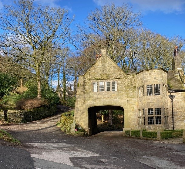
200 metres from the Hinchliffe, just past an arched gateway, take the tarmac road uphill signposted Old Cragg Hall (the interpretation board is worth a read)
The road winds up the hillside, when you reach a cluster of buildings ahead, this is the fine 17th century Old Bank Hall. Just before the hall take a hairpin left uphill on a narrow-walled lane.
When you reach a junction, bear left signed to Swan Bank, where you keep straight ahead, now on a track.
After ½ km, go through a metal gate and turn left on a tarmac road which gradually descends to rejoin the main route at Withens Clough Reservoir car park
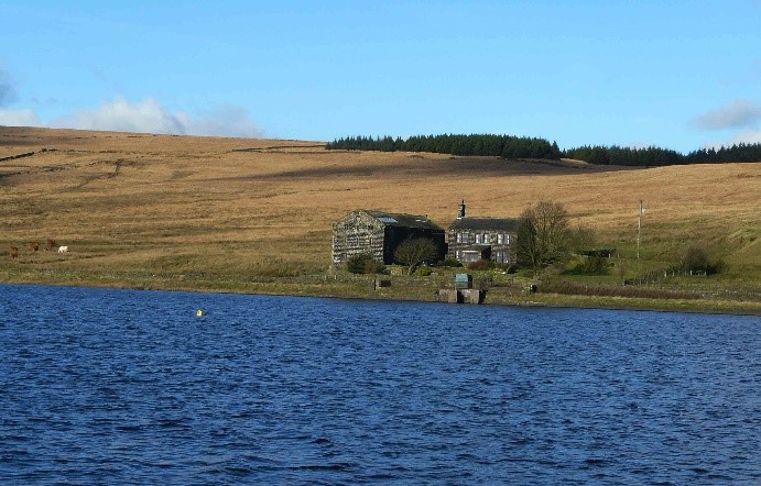
3. At the top of the road, go through gates to Withens Clough Reservoir. At the dam, keep on the track straight ahead along the right-hand edge of the reservoir. The track turns to the left and ½ km further on, turn right up a waymarked grassy track.
4. At the first junction of paths, you turn left on a permissive bridleway which avoids the old very wet Calderdale Way route.
5. Keep ahead and at a gate turn right uphill. You pass a stone stoop with the inscription “Te deum laudamus” (“We praise thee O Lord”) and go through the gate on to the moor, picking up a great stretch of old causey path.
6. After 200 metres you reach Withens Gate where you cross the Pennine Way with Stoodley Pike to the right. A great place to stop and admire the view.
7. Keep ahead going downhill on the causey path. The path picks up a wall on your right and shortly after you reach a gate going into a walled lane leading to Lumbutts and Lee Dam. Here you turn right on a walled grassy track down to the hamlet of Mankinholes.
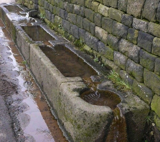
8. Go straight ahead on the tarmac road through the hamlet, watch out for the drinking troughs for cattle and pack horses and Mankinholes Hall, now the Youth Hostel.
9. At the end of houses, opposite the graveyard of a former Chapel, turn left down a walled lane on to the back of the Top Brink Inn.
10. Coming out of the pub, bear right and go down the setted path to Lumbutts with its distinctive water tower.
Here Link Path H is an easy way to the Castle Street at the Valley bottom and buses.