
Updated 19/03/2024
Length and time
3½ miles (5½ km). Should take you about 2½ hours.

Highlights
The 17th century buildings of Holdsworth (just off the route), Shibden Beck and more great panoramic views.

Gradients
There are a couple of steep climbs on this section.

Terrain
The route is all on good paths and tracks with some road walking.

Obstacles
There are many stiles to cross.

Facilities

Moorlands Inn on the Keighley Rd near the beginning of the route.

Bus access to the route
522 and 504 from Halifax to crossroads near to the Moorlands Inn
No buses from the Shibden Valley end of the walk.
Access from the previous section: Pass the chapel and continue along Per Lane to the cross roads with the main road.
1. From the corner of Per Lane and the Keighley Road (SE070298), cross the Keighley Road and walk along Blind Lane (which becomes a grass track) to its junction with a tarmac road. Cross the road and follow the waymarked track past two gates into a field. Cross the field to a gap-stile near a house.
2. Turn slight left down a track and where the track ends turn left into the yard, go between the buildings and watch out for a narrow-paved path off to the right
3. Walk through the garden and on a setted path to the field corner. Go down the narrow path to the road called to Riley Lane. (There is a bus service from here).
4. Cross the road diagonally to a gateway and take the narrow-walled path to the right of the drive. This goes into a field, where you follow the wall on your right.
5. At the bottom, go through a kissing gate on the tarmac road, turn right and just after the terrace of houses called St John’s Cross, turn left on a paved path which becomes a grassy track. Go through a metal kissing gate on your left.
(A pleasant and more sheltered alternative to point 6 below is to turn right here onto a field path after passing through the buildings and follow the path over stiles into a wood. Continue following the path until it emerges from the wood at Holdsworth.)
6. The track passes a farm and turns to the right, then gently descends. Look out for the waymarked path going off to the right towards some woods and follow this path straight ahead to another stile on the other side of the field.
7. Continue through a series of stiles to a grassy track alongside the factory fence. It ends at the 17th century hamlet of Holdsworth and meets the main road. (There is a bus service from here)
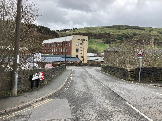
8. Turn left down the main road, for about 500 metres. Turn left again at the road signed to Holmfield Mills and then left again onto Brow Lane.
9. Continue up this road for another 500 metres, then turn right up Crooked Lane with a fine stone setted surface. It’s worth pausing as you climb up the lane to look back on the route you have walked so far. After about 500 metres, at the end of the lane, you reach Queensbury Road (A647) (There is a bus service from here)
10. Cross the road and immediately turn sharp right onto Swales Moor Road which you follow for about 200 metres. Turn left opposite Slack End to descend a steep concrete track, which winds down hill. About 40 metres after passing an old water trough and just before a layby, turn sharp right on a track running downhill through the woods.
11. After a gate, the path passes through holly trees, then bears left, where you walk beside an old sunken path to a stone gatepost. Continue ahead slightly left, down through another bank of holly. Turn sharp left, over two stiles and stone steps and follow a fenced path to a junction.
If you look straight ahead you will see Scout Hall which was built in 1680. It is worth the short detour.
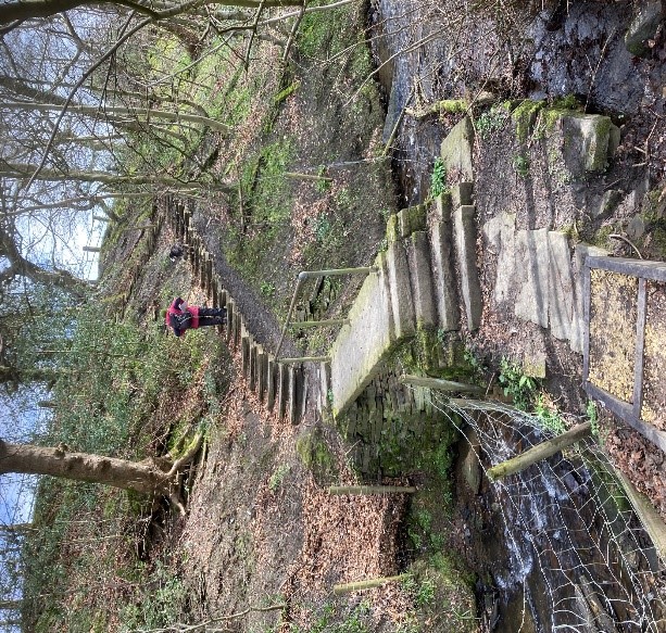
12. Turn left through a metal gate at the junction, following the wall to your right. Keep on the paved path down to Shibden Brook. Cross Shibden Brook by the stone footbridge and follow steps up to the tarmac lane.
13. Turn right, to pass the hamlet of Simm Carr (SEO97277) in approx. 200 metres. Just after, the Calderdale Way turns left and straight on is Link Path L heading to Halifax via the Shibden Mill Inn.